
Mount Harriet National Park
Hope Town, Port Blair ![]() View on Map
View on Map![]() View on Map
View on Map
About Mount Harriet National Park, Port Blair
Mount Harriet, located in Hope Town, Port Blair is the second-highest peak in the Andaman Islands, 365m high. During the British reign, Mount Harriet used to be the headquarters of the chief commissioner. The national park was renamed as Mount Manipur National Park – so don’t get confused since its the same spot.
Today, it is a major tourist attraction in the Andaman and Nicobar Islands and the highest peak, standing at 365 mts, in South Andaman.
Experience Breathtaking Views at Mount Harriet National Park
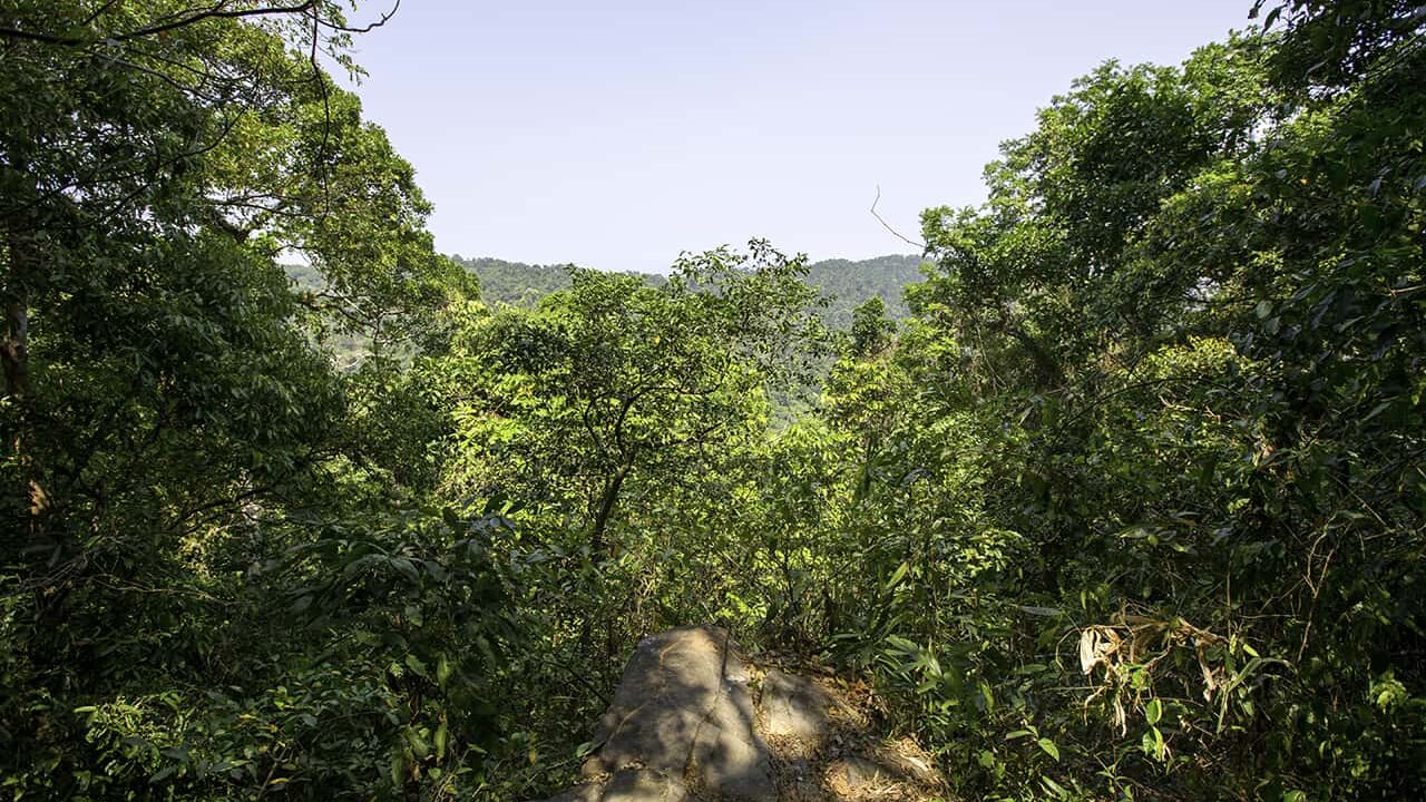
The trek toward the top of the national park might be challenging, but the views make it worth it. On a clear day, you can spot the nearby islands of Port Blair, Ross Island, and Havelock from Mount Harriet. This panoramic view of the Andaman Islands is a once-in-a-lifetime experience. We at Go2Andaman recommend trekking through this national park to truly experience its natural ecosystem.


How To Reach Mount Harriet National Park
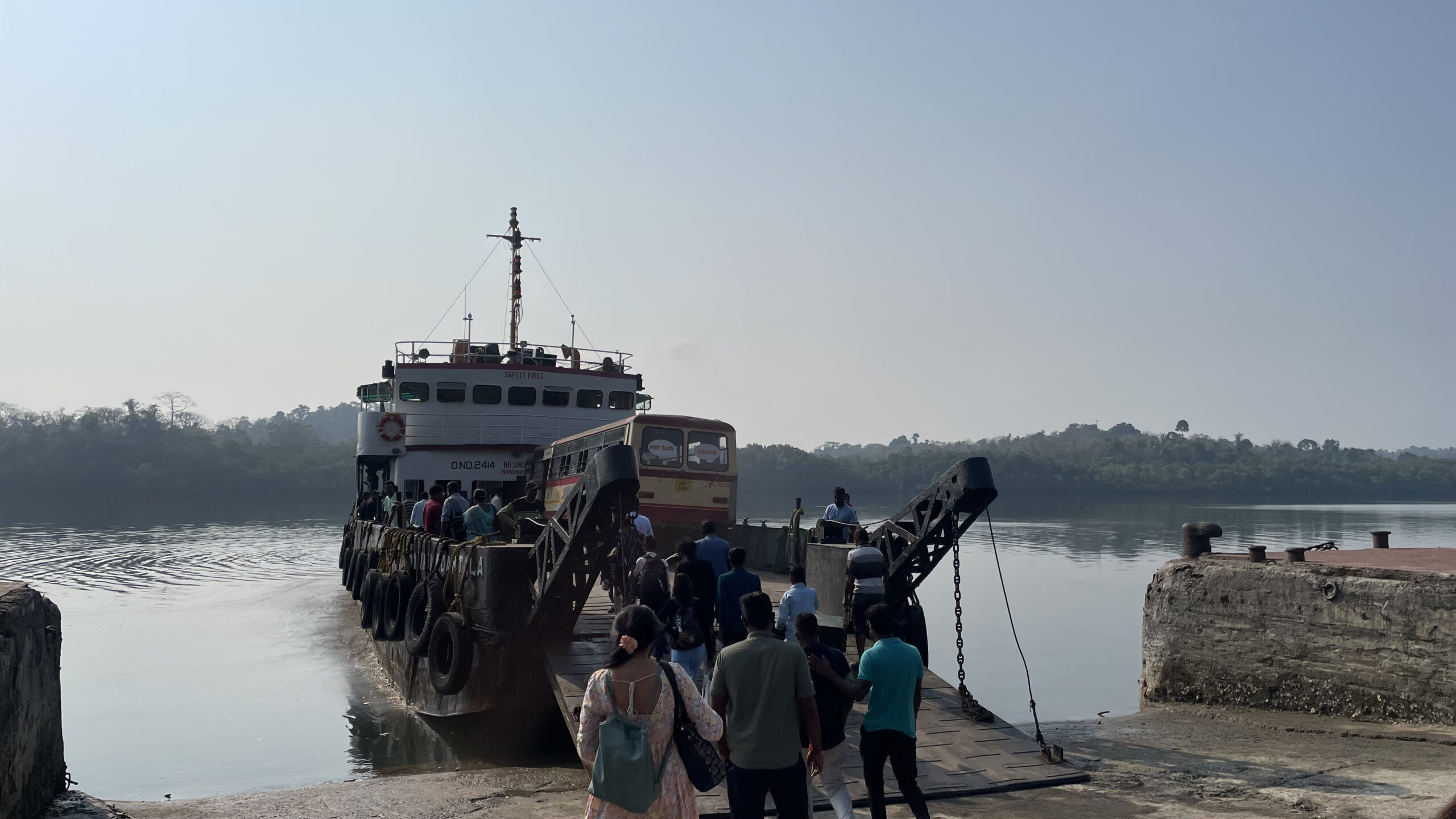
The Sea Route To Reach Mount Harriet National Park:
The sea route spans 11 kilometers from Port Blair and takes approximately 45 minutes from the city center. You can start the journey from Port Blair, but if you are in Neil Island or Havelock then book a ferry from either Neil to Port Blair or from Havelock to Port Blair. To take the sea route, head to Chatham Jetty via car, autorickshaw, or 2-wheeler. Buses are an option but might not be comfortable. You can take a vehicle ferry and deboard at Bamboo Flat Jetty. From here Mount Harriet National Park is only 6 kilometres away.
The Land Route To Reach Mount Harriet National Park
This is a longer route and spans about 45 kilometers via NH 4. It takes an hour and half or even longer to reach Mout Harriet from Port Blair by road.
The best option is to take the shorter sea route to enjoy more time at the national park.
Read More: Best Time to Visit Port Blair
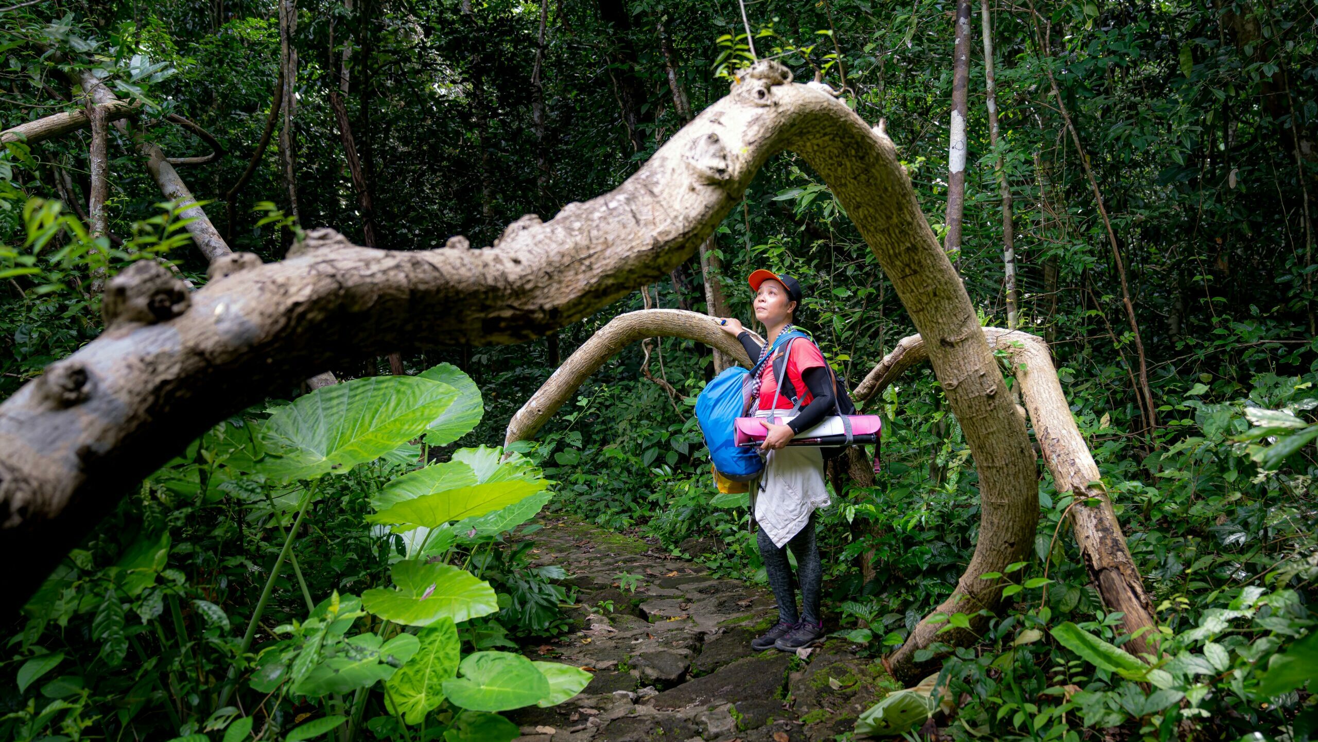
Trekking in Mount Harriet National Park – All You Need To Know
We know trekking is not possible for some tourists, so there is an alternative. You can drive almost all the way to the peak. So don’t hold back from experiencing this beautiful escape into lush greenery.
For adventure enthusiasts, Mount Harriet National Park is home to many trekking trails with different difficulty levels.
- The shortest trek is 3 Kilometers. This trek begins at Mount Harriet and reaches the Kala Pathar rocks.
- An alternate trek spans from Hope Town, where the national park is located, to Kala Pathar. This trail covers a total distance of 4 kilometers.
If you are seeking longer and more challenging treks, then Mount Harriet National Park won’t disappoint.
- You can trek a whopping 10 kilometers from Mannarghat to Madhubhan beach. The trek might be a little tough but the sense of achievement you feel is unmatchable.
- You can also trek from Madhubhan Beach to the Forest Guest in the national park. The trek is 15 kilometres long but once you complete it, you have the option to rest at the guest house.
Read More: Things to Do in Port Blair
Do I Need Permits To Trek In Mount Harriet National Park?
You don’t need a permit for shorter treks in Mount Manipur National Park. For longer treks, a permit is required. The procedure is fairly simple.
- Make a Request to the authorities of the forest department and mention all the necessary details.
- You can then pick up your permit at the check post.
- We also recommend coordinating with the warden’s office, at least a day prior to your trek, and requesting a guide. Don’t embark on longer treks without the help of a guide.
These treks in Mount Harriet National Park are perfect for adventure junkies. If you have had your fill of the beaches in Port Blair and other Andaman and Nicobar islands then these treks will offer a refreshing change.
Precautions To Take When Trekking In Mount Harriet National Park
The longer treks in Mount Harriet can be quite demanding, so:
- Wear appropriate and comfortable clothing. Ideally, wear clothes with long pants and sleeves and add a cap too.
- Mosquito repellents are your best friend – so lather yourself in repellent creams and sprays to avoid bites.
- Carry ample water and snacks. The heat coupled with the humidity of the Andaman and Nicobar Islands can be draining. So stay hydrated and energized.
- Be mindful of the national ecosystem of the national park. It is a reserve forest and is home to many tree species and even endangered species. Carry trash bags and pick up your trash as you go. We recommend doing this across the Andamans. Even if you enjoy water sports, be sure not to disturb the fragile marine ecosystem of the Andaman waters.
- The dense forests are home to many animals. These include insects and wild birds. Keep an eye out for snakes, spiders, and giant land crabs.
- As Andaman locals ourselves, we recommend starting your trek in the early morning hours.
- The best time to trek in Mount Harriet National Park is in the dry season. Once the monsoons set in, the treks get harder because of the wet terrain and the influx of insets.
Visitors Information
Entry Cost
Timings
Extra Cost
Address
Closed on
- Buy Mount Harriet National Park Entry Tickets
- Book Guided Tours of Mount Harriet National Park
- Book Sightseeing Tour of Port Blair
Tickets & Guided Tours
book for september BOOK TOUR